
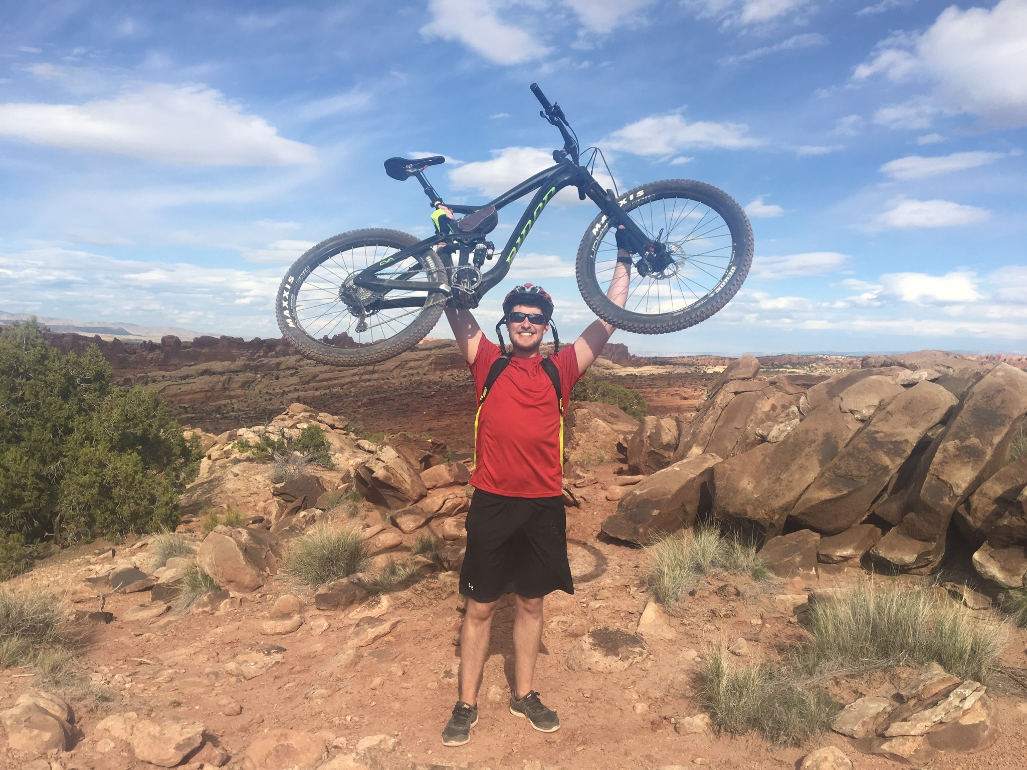
A little-known gem at Clemson University is CORE. CORE organizes amazing trips, offers workshops teaching outdoor skills, and provides excellent rental equipment for university students. I took a leap of faith for spring break and decided to sign up for their mountain biking trip to Moab, Utah. Prior to the trip, you could say my mountain biking experience was lacking…I had never ridden a mountain bike on anything that would be considered an official trail. Moab is known for having some of the best and most difficult mountain biking trails in the world, so I was banking on being a quick study.
We were gung-ho and drove 27 hours straight to Moab. We set up camp at the wonderful Sand Flats Recreation Area. I would highly recommend this campsite to anyone thinking about visiting Moab, but be wary it is first come first serve, so come early in the day for a good spot.
Mountain Biking Trails
We had 5 days to mountain bike and we weren’t going to waste any of it. We hit 5 different trail areas and had a blast riding them.
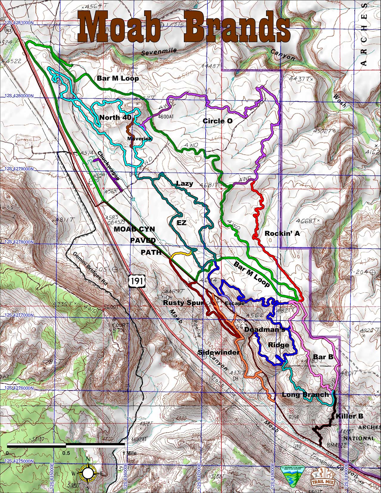
Moab Brand Trails
On day 1, we started out at Moab Brands. To get our bearings, our trip leader thought it would be best to start off with the EZ Loop. Once the group felt comfortable, we moved on to the slightly more difficult Bar M Loop. The Bar M Loop contained some nice casual dirt trails with a few rocky sections. We got our first feel for what the future entailed when riding the small slickrock section Circle-O. All together, we rode about 12 miles the first day, a great start!
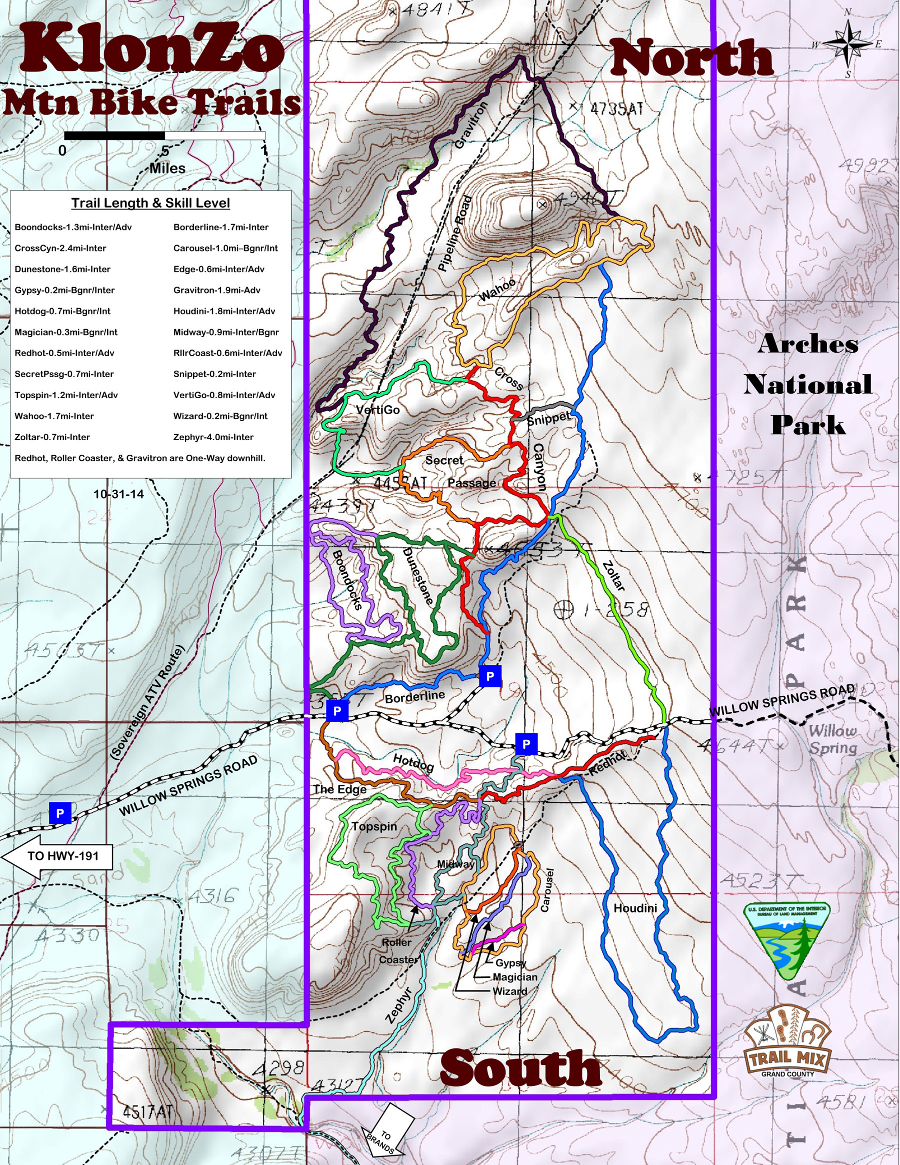
Klonzo Trails
Day 2 brought new adventures at the Klonzo trails. Klonzo is known for having some great redrock dirt trails. We rode Borderline up to the Wahoo Loop to kickoff the day. We then came back to the parking lot by riding on a small portion of Cross Canyon to Dunestone. I learned the importance of shifting this day after I sheared a derailleur from trying to brute force my way up a climb.
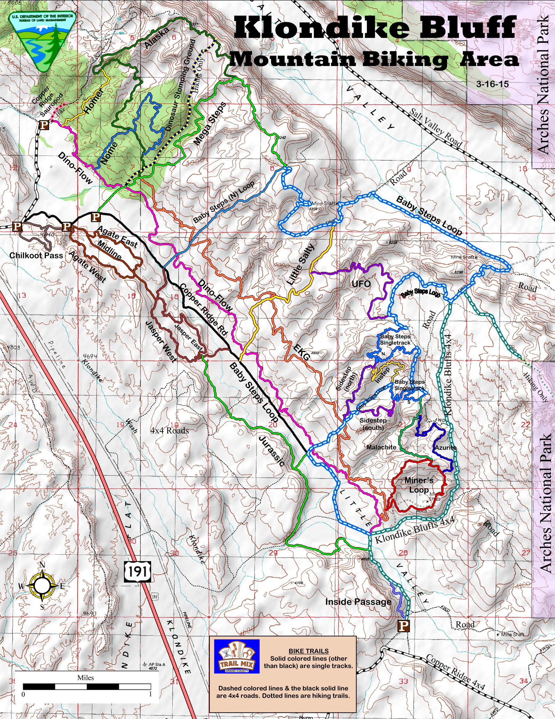
Klondike Bluffs
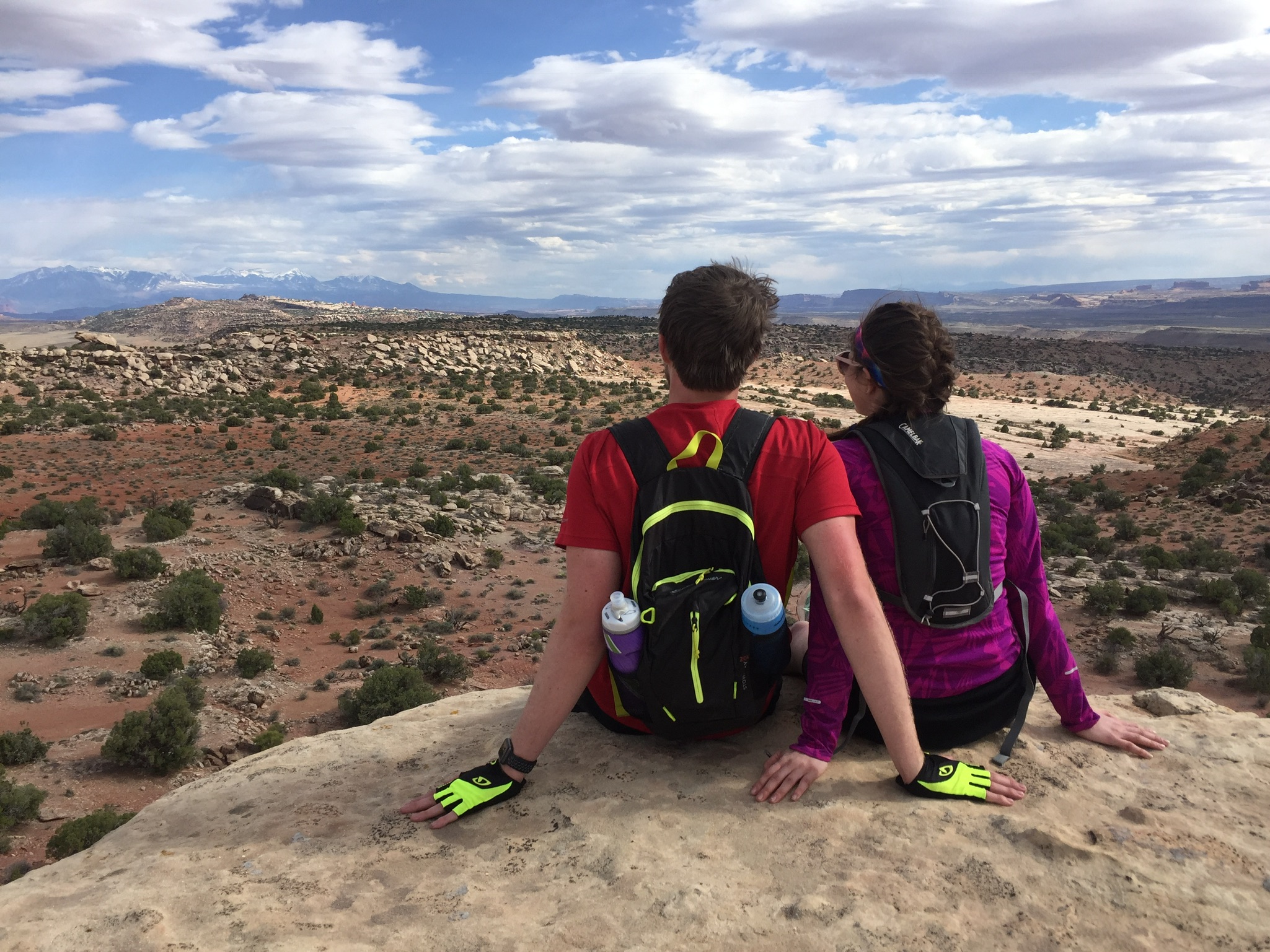
The next day, we decided to take on the renowned Klondike Bluffs. Klondike Bluffs is unique in that dinosaur fossils and tracks can and have been discovered in the area. We stuck to the Baby Steps Loop for the day. Don’t be fooled by the name, the trail began with a brutal 1,700 ft climb. The climb was absolutely worth it when we were rewarded with an amazing view of the rest of Moab from the top of the ridge. The descent down the trail was incredibly fun and fast, weaving through redrocks and trees. This personally was my favorite day of the trip.
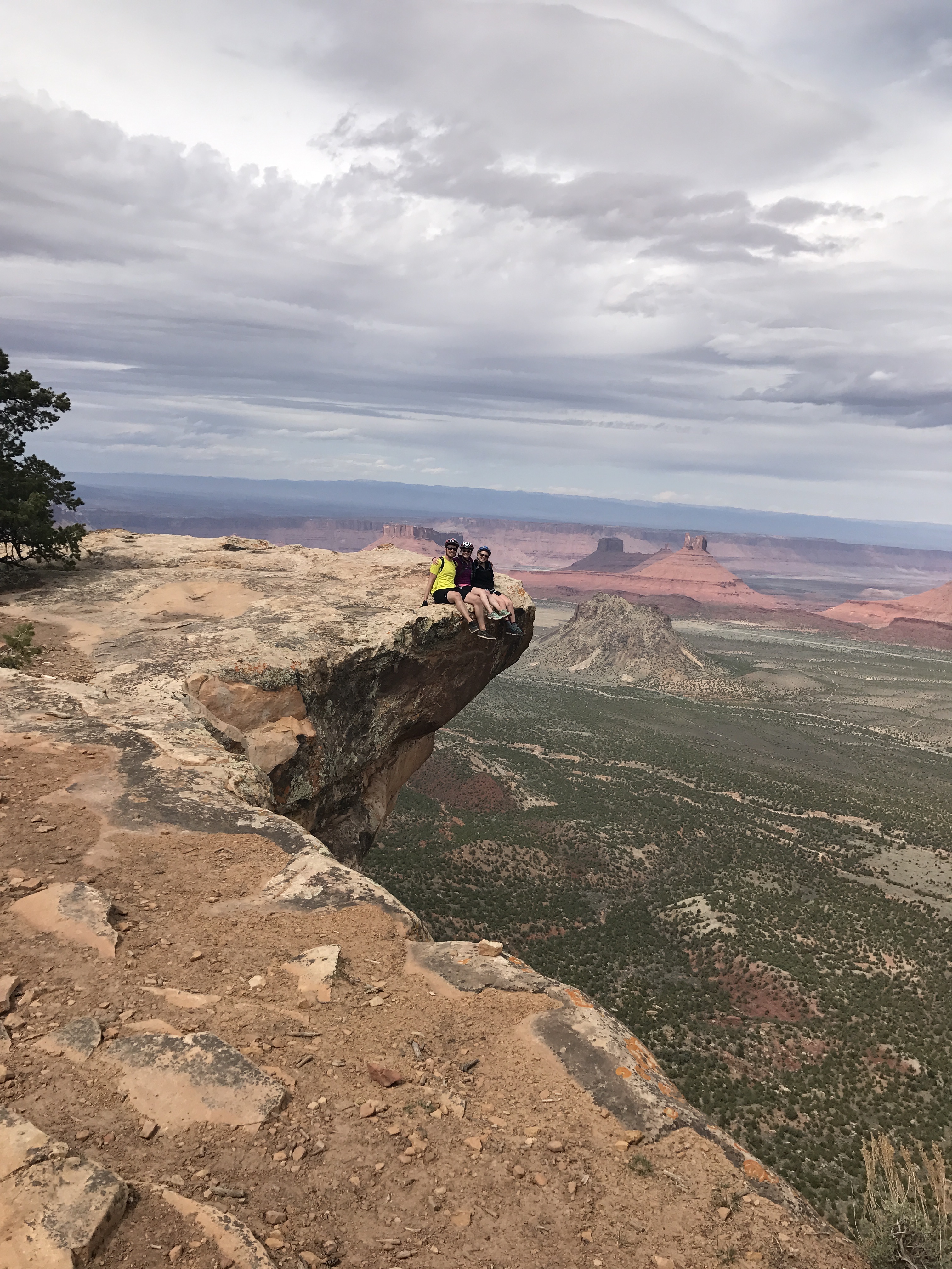
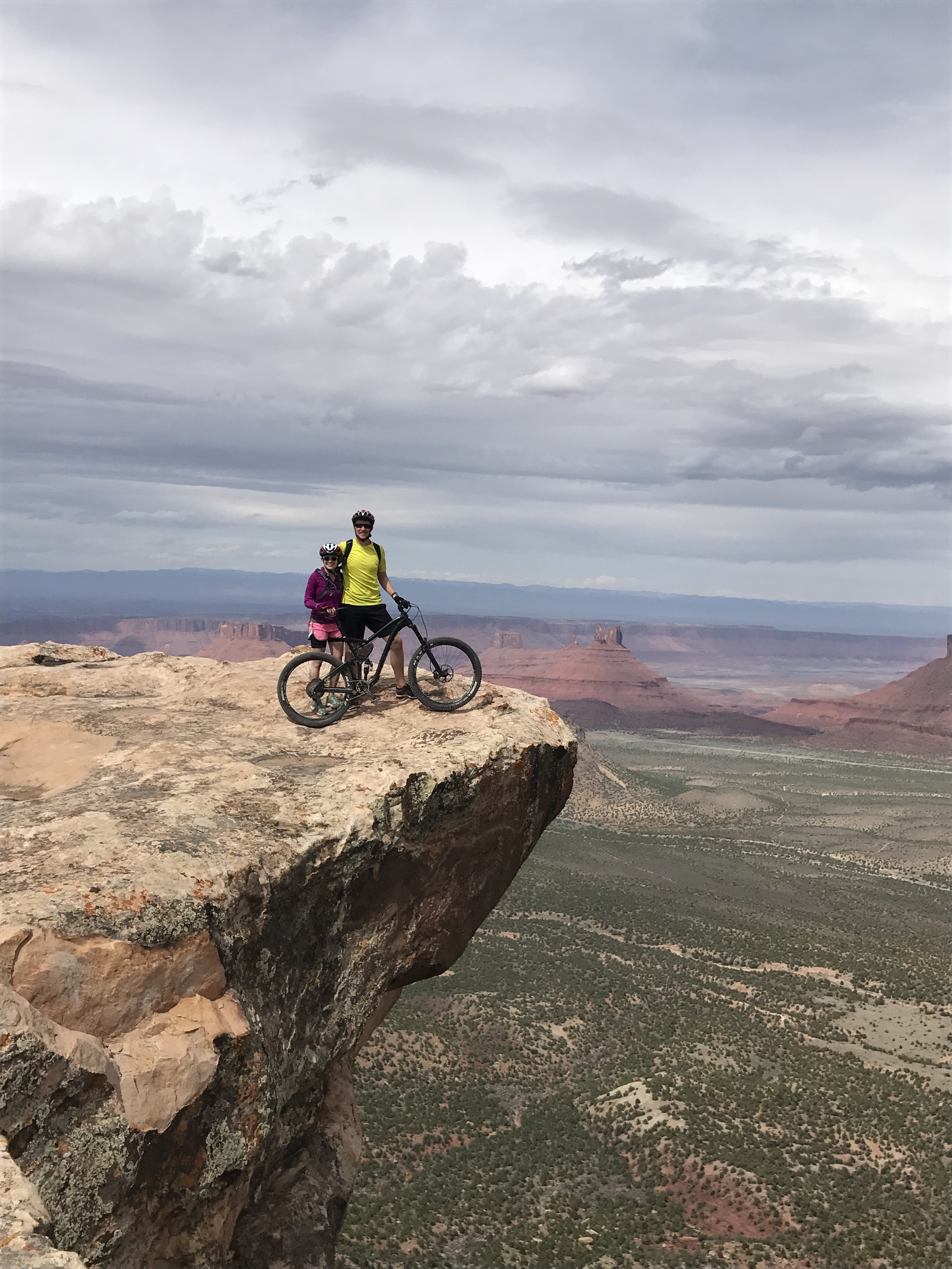
Porcupine Rim
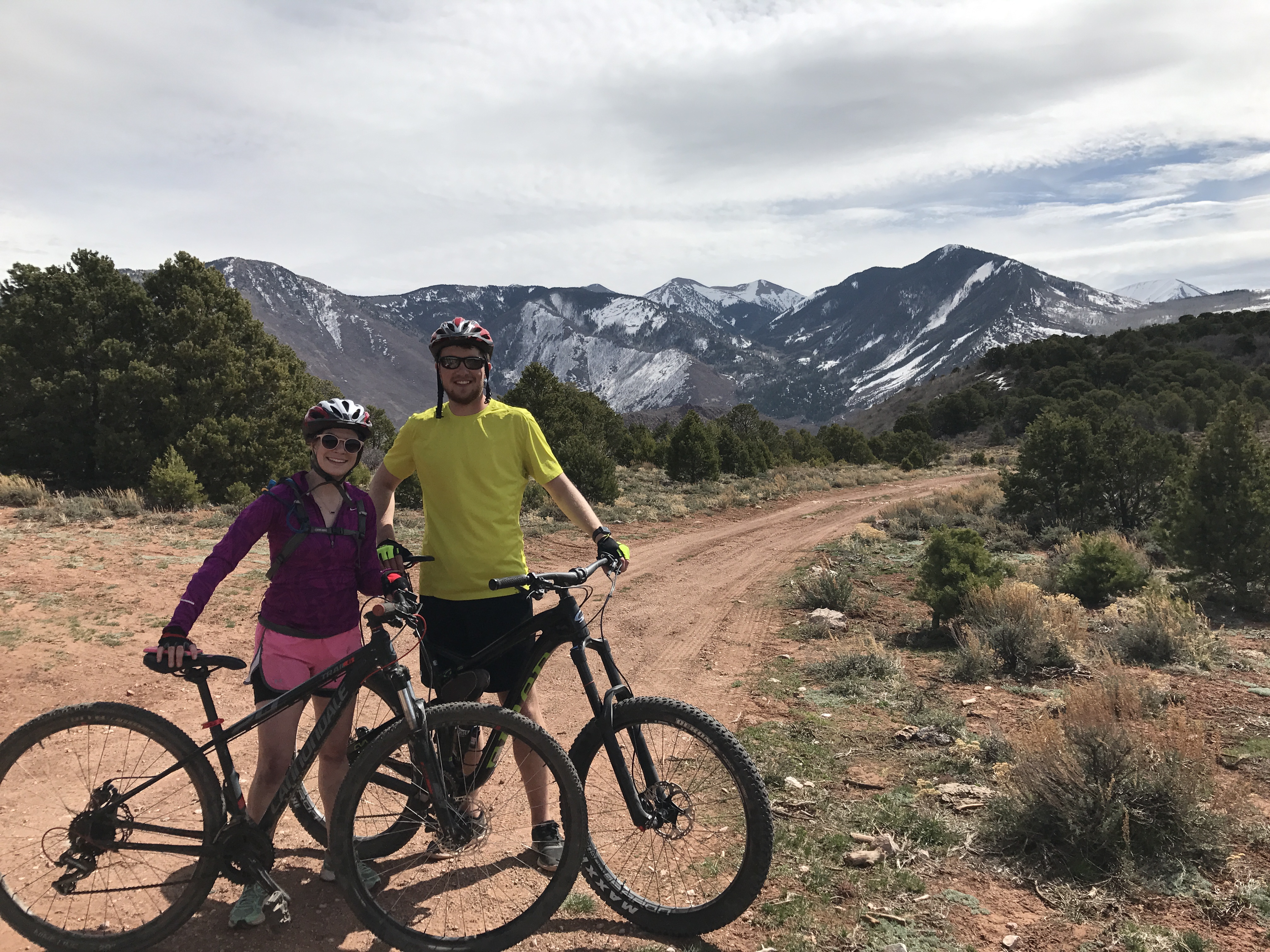
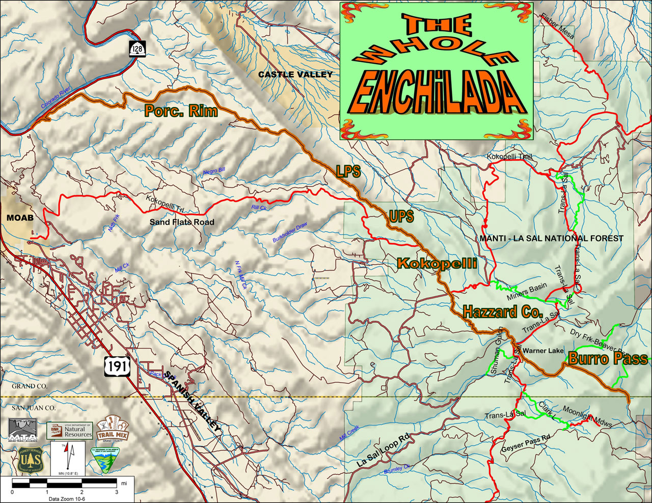
The Whole Enchilada is a world famous mountain biking trail that takes riders down from the alpine peak to the beautiful redrock desert, encompassing 31 miles of trail and 8,000 feet of descent. Unfortunately, the top of the peak was still mostly frozen when we were in Moab, so we opted for the shorter, but equally awesome, Porcupine Rim Trail. We caught a shuttle to the trailhead, and then the trail was a fantastic 13 miles of descent with some sections that were exceedingly technical (3+ ft drops), so many of us opted to walk those sections. After all my days of experience, I became more confident and began riding towards the front of the pack. I had a blast in the upper section of the trail which twists through a winding dirt path in the woods.
You start pretty high up..
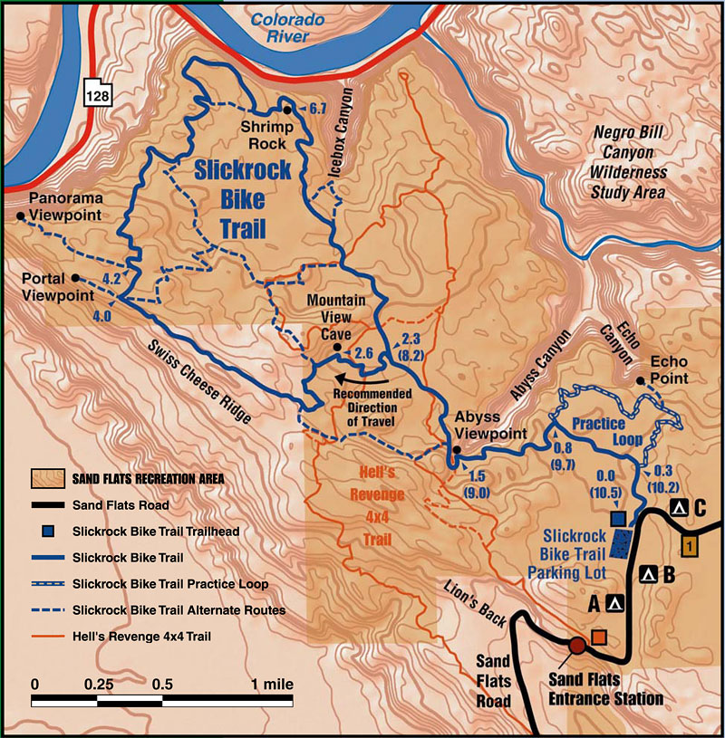
Slickrock
On the last day, most of the group was exhausted from the intense Porcupine Rim ride. However, a few of us couldn’t get enough time on the bike so we decided to spend the last day at Slickrock instead of at camp relaxing. Since we were already staying at the Sand Flats Recreation Area, we could easily ride our bikes to the trailhead for Slickrock. This trail was ultimately the most difficult due to the technicality of the trail. Most of the trail was very steep descents (~9°) followed by equally steep climbs. Being tired from Porcupine Rim, we had to walk up most of the climbs. It was still a very fun trail!
Arches
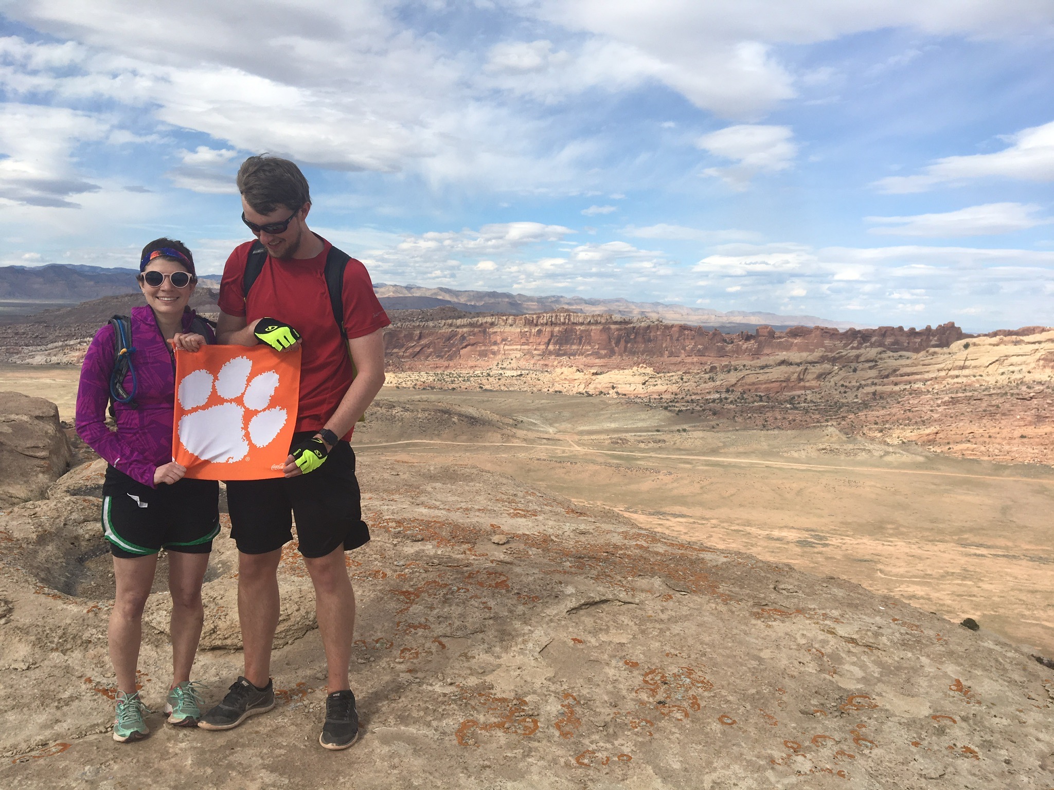
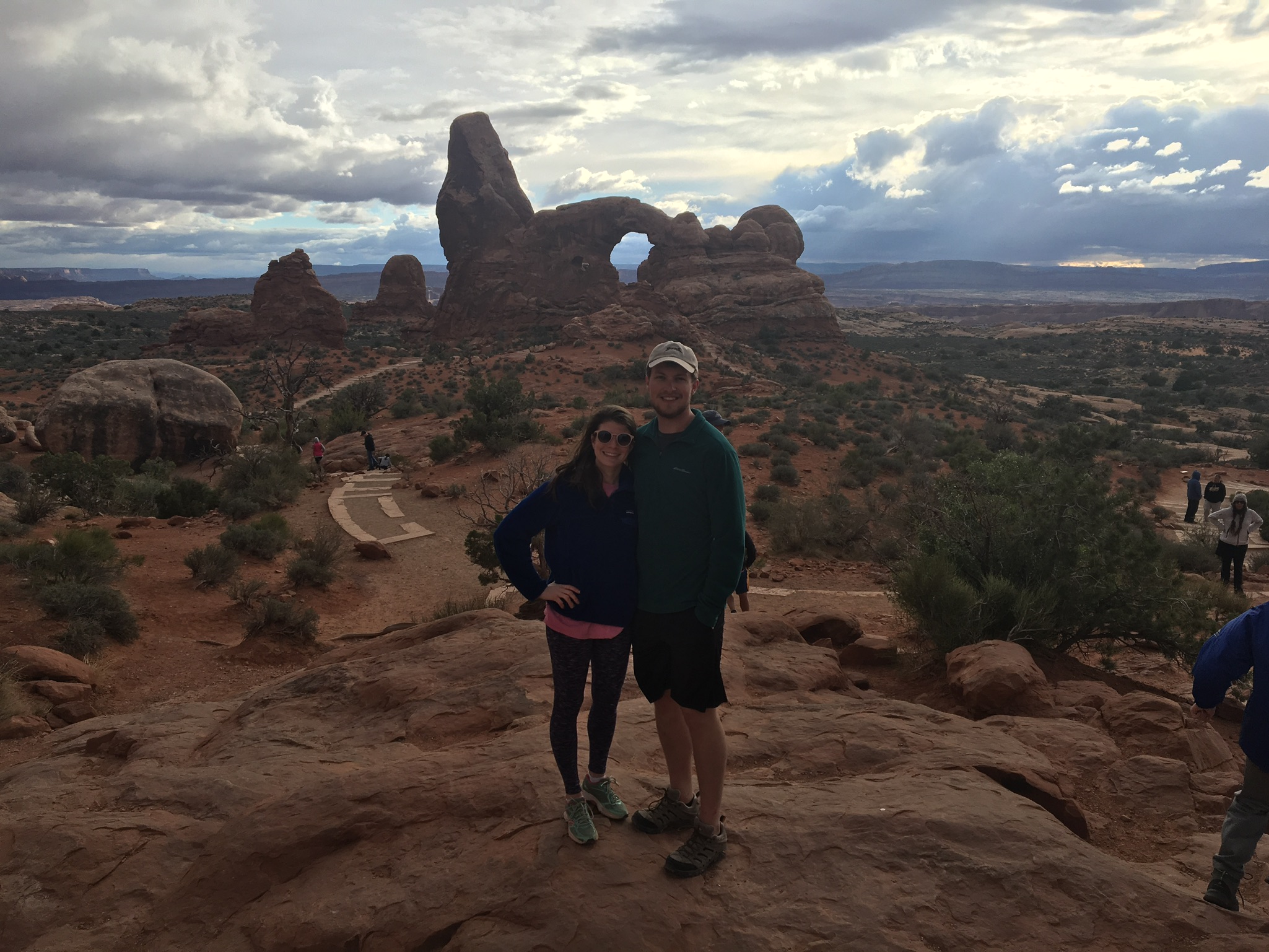
No trip to Moab would be complete without a trip to the fantastic Arches National Park!
Special thanks to the Trail Mix Committee for their awesome trail blazing work and their informative maps.